Breaking News
64 Years Without a Border One Road, Two Union Leave Residents in Administrative Limbo.
Reporter :
Editor :
National
>
Chattogram
31 August 2026 09:45 PM
45
Views
Jahangir Alam , Staff Reporter.
It is the exact same road, yet walking down one side puts you in Munshirhat Union, while stepping across to the other places you in Darbarpur Union. Village identities conflict with union titles, and the primary hub of daily life—the local market—has been split down the middle between two administrative jurisdictions. For over 64 years, thousands of residents in the border area of Fulgazi Upazila, Feni, have been facing severe administrative hurdles due to a prolonged boundary dispute.
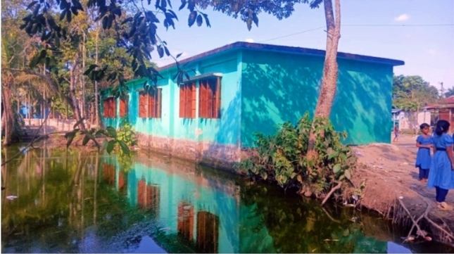
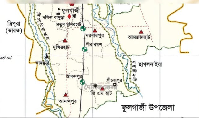
Local sources report that heading north from the Silonia River bridge along the Feni–Parshuram regional highway, one side of the road falls under Darbarpur Union while the opposite side belongs to South Sreepur village under Munshirhat Union. The Fulgazi Upazila Health Complex, located right nearby, operates under Darbarpur Union. However, just a short distance away, Fatehpur village and the New Munshirhat Market fall within Munshirhat Union.
The most bizarre geographical anomaly lies in the placement of the Union Parishad offices. The Darbarpur Union Parishad office is situated near the Old Munshirhat Market. Conversely, the Munshirhat Union Parishad complex sits in New Munshirhat Market on the Fatehpur mouza. As a result, despite sharing the same marketplace and healthcare facility for daily necessities, residents remain administratively isolated on paper.
This market serves as the central hub for residents across multiple villages in Munshirhat Union, including Kamalla, Paithara, South Taralia, Kamua, Balua, South Sreepur, and Kutubpur. On the other hand, residents of Basantapur, Jagatpur, and South Baraiya must pass directly in front of another union's office and travel nearly three kilometers out of their way just to reach their designated Union Parishad.
Expressing his frustration, Delowar Hossain, a resident of Fatehpur village, said, "Having two different unions on opposite sides of the exact same street creates massive administrative confusion. Obtaining NIDs, certificates, or emergency services turns into an endless hassle."
Historical records show that this boundary complication originated during the Pakistan era under the 1962 'Basic Democracies' administrative reorganization. The former, larger Munshirhat Union was subsequently partitioned into two distinct entities: Munshirhat and Darbarpur.
According to the 2022 census, Munshirhat Union has a population of 22,067 across an area of 18.33 sq km, while Darbarpur Union has 17,238 residents spanning 11.62 sq km. Because these borders have remained unchanged for over six decades, the official administrative map no longer reflects local settlement patterns, market-centric daily life, or ground transportation realities.
Addressing the issue, Fulgazi Upazila Election Officer Pallabi Chakma stated that boundary redelineation falls entirely under the jurisdiction of the Local Government Division.
Suffering residents have called upon higher authorities to re-evaluate and adjust the boundaries between the two unions in the public interest and in accordance with ground realities.
Related News